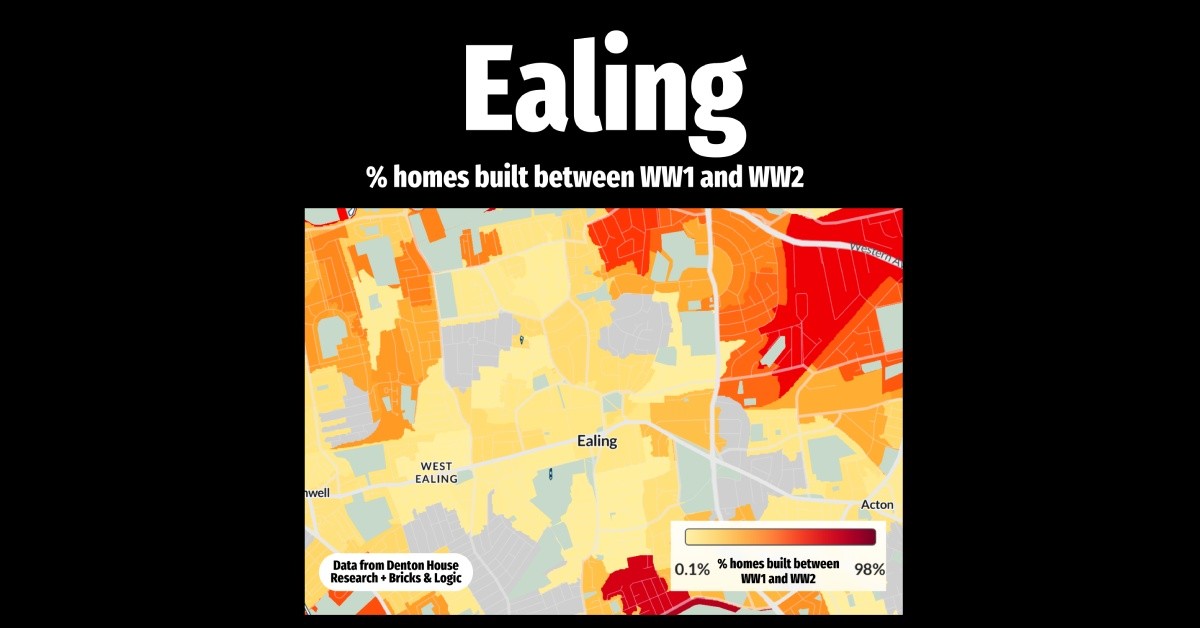
HEAT MAP ON HOMES BUILT BETWEEN WW1 & WW2

This heat map of Ealing visually highlights the areas with homes built between World War I and World War II. The darker the red regions represent the areas of Ealing that have a higher concentration of homes from this period. These areas stand out against the grey regions, where no homes from that era exist.
The interwar period was marked by a challenging economic landscape. The Great Depression of the 1930s caused widespread unemployment and reduced economic activity, making home construction difficult. Additionally, funding for public housing was limited, and high-interest rates deterred private investment. Social unrest and political instability further dampened growth in the property market.
Despite these conditions, certain areas in Ealing experienced growth, reflecting the changing housing needs and the influence of early urban planning efforts. This graphic provides a fascinating insight into the area’s development and offers a window into a unique chapter of British housing history.
Author Homesearch

Looking to buy?
We'd love to help you on your journey home.
Don't miss out on on the latest properties by registering for our property alerts.
Read What Our
Customers Say

Expert Valuation
We always come armed with evidence and statistics of why we are pricing your property a certain way. We know the importance of getting the initial price of your property right, first time. With our extensive experience we will also explain current market conditions as we want to get our sellers the best price.
What's more, get a free gift with your free expert valuation with one of our experienced Valuer's.
Book a Valuation